
Boulangerie et boulangerie-pâtisserie en région Pays-de-la-Loire
1 630 boulangeries pâtisseries sont référencés sur la région Pays-de-la-Loire
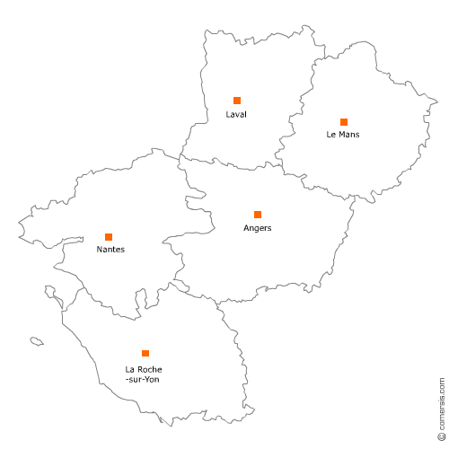
Vous recherchez une boulangerie ou une boulangerie-pâtisserie dans les Pays-de-la-Loire ?
La région Pays-de-la-Loire représente 4% des boulangeries pâtisseries de France.
C'est le département de Loire-Atlantique qui compte le plus de boulangeries pâtisseries dans les Pays-de-la-Loire.
C'est le département de Loire-Atlantique qui compte le plus de boulangeries pâtisseries dans les Pays-de-la-Loire.
Boulangerie et boulangerie-pâtisserie dans le Maine-et-Loire (49)
Secteur d'Angers
Indice d'implantation
| Commune | Nb Pro | Habitants | Distance | |
|---|---|---|---|---|
| Angers - 49000 | 103 | 150125 | 0,0 | km |
Secteur de Trélazé
Indice d'implantation
| Commune | Nb Pro | Habitants | Distance | |
|---|---|---|---|---|
| Trélazé - 49800 | 10 | 13125 | 0,0 | km |
| Saint-Barthélemy-d'Anjou - 49124 | 5 | 9077 | 3,2 | km |
| les Ponts-de-Cé - 49130 | 5 | 12112 | 5,3 | km |
| le Plessis-Grammoire - 49124 | 1 | 2335 | 6,7 | km |
| Mûrs-Erigné - 49610 | 2 | 5368 | 8,6 | km |
| Écouflant - 49000 | 3 | 3798 | 10,3 | km |
| Bouchemaine - 49080 | 7 | 6589 | 10,9 | km |
| Avrillé - 49240 | 8 | 12972 | 11,3 | km |
| Cantenay-Épinard - 49460 | 1 | 2044 | 12,2 | km |
| Beaucouzé - 49070 | 3 | 4935 | 12,8 | km |
| Briollay - 49125 | 2 | 2789 | 13,5 | km |
| Montreuil-Juigné - 49460 | 3 | 7213 | 14,0 | km |
| Feneu - 49460 | 2 | 2184 | 16,7 | km |
| la Membrolle-sur-Longuenée - 49770 | 1 | 6211 | 19,9 | km |
Secteur de Saumur
Indice d'implantation
| Commune | Nb Pro | Habitants | Distance | |
|---|---|---|---|---|
| Saumur - 49400 | 30 | 27413 | 0,0 | km |
| Distré - 49400 | 1 | 1684 | 4,7 | km |
| Chacé - 49400 | 2 | 3 | 4,8 | km |
| Allonnes - 49650 | 2 | 2980 | 8,6 | km |
| Neuillé - 49680 | 2 | 988 | 9,9 | km |
| Brain-sur-Allonnes - 49650 | 2 | 1987 | 12,0 | km |
| Fontevraud-l'Abbaye - 49590 | 1 | 1546 | 12,5 | km |
| Longué-Jumelles - 49160 | 6 | 6875 | 13,8 | km |
| les Rosiers-sur-Loire - 49350 | 4 | 2327 | 15,4 | km |
| Mouliherne - 49390 | 1 | 883 | 24,4 | km |
Secteur de Cholet
Indice d'implantation
| Commune | Nb Pro | Habitants | Distance | |
|---|---|---|---|---|
| Cholet - 49300 | 45 | 53890 | 0,0 | km |
| Bégrolles-en-Mauges - 49122 | 1 | 1977 | 10,0 | km |
| Maulévrier - 49360 | 4 | 3179 | 11,4 | km |
Secteur de Chalonnes-sur-Loire
Indice d'implantation
| Commune | Nb Pro | Habitants | Distance | |
|---|---|---|---|---|
| Chalonnes-sur-Loire - 49290 | 7 | 6528 | 0,0 | km |
| Saint-Georges-sur-Loire - 49170 | 3 | 3529 | 6,1 | km |
| la Possonnière - 49170 | 2 | 2416 | 6,5 | km |
| Saint-Germain-des-Prés - 49170 | 2 | 1400 | 8,0 | km |
| Rochefort-sur-Loire - 49190 | 3 | 2290 | 8,1 | km |
| Champtocé-sur-Loire - 49123 | 1 | 1866 | 9,9 | km |
| Saint-Lambert-du-Lattay - 49750 | 1 | 3265 | 11,4 | km |
| Denée - 49190 | 2 | 1398 | 12,3 | km |
| Beaulieu-sur-Layon - 49750 | 2 | 1416 | 14,2 | km |
| Mozé-sur-Louet - 49610 | 1 | 2045 | 16,2 | km |
| Saint-Melaine-sur-Aubance - 49610 | 3 | 2044 | 20,4 | km |
| Thouarcé - 49380 | 2 | 5712 | 22,1 | km |
| Juigné-sur-Loire - 49610 | 1 | 2621 | 22,4 | km |
| Brissac-Quincé - 49320 | 7 | 3059 | 24,2 | km |
| Chavagnes - 49380 | 1 | 1247 | 25,4 | km |
Secteur de Lys-Haut-Layon
Indice d'implantation
| Commune | Nb Pro | Habitants | Distance | |
|---|---|---|---|---|
| Vihiers - 49310 | 3 | 7882 | 0,0 | km |
| Montilliers - 49310 | 1 | 1208 | 4,8 | km |
| Saint-Paul-du-Bois - 49310 | 1 | 610 | 7,4 | km |
| Coron - 49690 | 1 | 1572 | 8,8 | km |
| la Plaine - 49360 | 1 | 1029 | 11,6 | km |
| Vezins - 49340 | 1 | 1643 | 13,8 | km |
| Somloire - 49360 | 1 | 914 | 13,8 | km |
| Yzernay - 49360 | 1 | 1829 | 18,9 | km |
| Trémentines - 49340 | 3 | 2823 | 19,5 | km |
| Toutlemonde - 49360 | 2 | 1208 | 20,4 | km |
| Nuaillé - 49340 | 1 | 1516 | 20,8 | km |
| Mazières-en-Mauges - 49280 | 1 | 1055 | 24,2 | km |
| le May-sur-Èvre - 49122 | 3 | 3953 | 27,2 | km |
| la Tessoualle - 49280 | 3 | 3076 | 28,6 | km |
| Saint-Léger-sous-Cholet - 49280 | 4 | 2609 | 29,3 | km |
| la Séguinière - 49280 | 5 | 3967 | 32,1 | km |
| Saint-Christophe-du-Bois - 49280 | 2 | 2584 | 33,9 | km |
| la Romagne - 49740 | 1 | 1782 | 38,3 | km |
Secteur de Doué-en-Anjou
Indice d'implantation
| Commune | Nb Pro | Habitants | Distance | |
|---|---|---|---|---|
| Doué-la-Fontaine - 49700 | 10 | 7584 | 0,0 | km |
| Louresse-Rochemenier - 49700 | 2 | 799 | 6,0 | km |
| le Puy-Notre-Dame - 49260 | 2 | 1218 | 8,2 | km |
| Vaudelnay - 49260 | 1 | 1195 | 8,4 | km |
| Courchamps - 49260 | 1 | 474 | 8,7 | km |
| Ambillou-Château - 49700 | 1 | 1778 | 9,4 | km |
| Montreuil-Bellay - 49260 | 3 | 4030 | 11,4 | km |
| Varrains - 49400 | 1 | 1244 | 15,9 | km |
| Saint-Clément-des-Levées - 49350 | 2 | 1157 | 16,6 | km |
| Vivy - 49680 | 1 | 2506 | 21,8 | km |
| Varennes-sur-Loire - 49730 | 1 | 1891 | 25,0 | km |
| Saint-Philbert-du-Peuple - 49160 | 1 | 1290 | 27,9 | km |
| Vernantes - 49390 | 1 | 1975 | 32,9 | km |
| Vernoil-le-Fourrier - 49390 | 2 | 1256 | 34,0 | km |
Secteur de Tiercé
Indice d'implantation
| Commune | Nb Pro | Habitants | Distance | |
|---|---|---|---|---|
| Tiercé - 49125 | 3 | 4287 | 0,0 | km |
| Cheffes - 49125 | 1 | 980 | 3,2 | km |
| Étriché - 49330 | 2 | 1523 | 4,4 | km |
| Montreuil-sur-Loir - 49140 | 1 | 502 | 4,7 | km |
| Seiches-sur-le-Loir - 49140 | 5 | 2974 | 8,9 | km |
| Lézigné - 49430 | 1 | 1 | 13,1 | km |
| Morannes - 49640 | 1 | 2060 | 14,9 | km |
| Durtal - 49430 | 4 | 3382 | 17,8 | km |
| Jarzé - 49140 | 2 | 2722 | 18,7 | km |
| Montigné-lès-Rairies - 49430 | 1 | 378 | 19,9 | km |
| les Rairies - 49430 | 2 | 977 | 20,1 | km |
Secteur de Sèvremoine
Indice d'implantation
| Commune | Nb Pro | Habitants | Distance | |
|---|---|---|---|---|
| Saint-Macaire-en-Mauges - 49450 | 4 | 24970 | 0,0 | km |
| Beaupréau - 49600 | 7 | 22485 | 8,8 | km |
| Montrevault - 49110 | 1 | 16064 | 15,9 | km |
| Chemillé - 49120 | 5 | 21304 | 22,1 | km |
| la Pommeraye - 49620 | 4 | 18250 | 27,5 | km |
| Champtoceaux - 49270 | 1 | 16025 | 31,5 | km |
Secteur de Baugé-en-Anjou
Indice d'implantation
| Commune | Nb Pro | Habitants | Distance | |
|---|---|---|---|---|
| Baugé - 49150 | 5 | 11873 | 0,0 | km |
| Beaufort-en-Vallée - 49250 | 6 | 7009 | 14,2 | km |
| Mazé - 49630 | 2 | 5578 | 15,7 | km |
| Noyant - 49490 | 4 | 1879 | 17,0 | km |
| la Ménitré - 49250 | 2 | 2102 | 20,1 | km |
Secteur de Segré-en-Anjou Bleu
Indice d'implantation
| Commune | Nb Pro | Habitants | Distance | |
|---|---|---|---|---|
| Segré - 49500 | 8 | 6925 | 0,0 | km |
| Chazé-sur-Argos - 49500 | 1 | 1053 | 7,9 | km |
| Bourg-l'Évêque - 49520 | 1 | 231 | 12,0 | km |
| Angrie - 49440 | 1 | 968 | 15,2 | km |
| Candé - 49440 | 2 | 2916 | 19,1 | km |
| Pouancé - 49420 | 3 | 3031 | 23,4 | km |
Secteur d'Erdre-en-Anjou
Indice d'implantation
| Commune | Nb Pro | Habitants | Distance | |
|---|---|---|---|---|
| Vern-d'Anjou - 49220 | 4 | 5648 | 0,0 | km |
| le Louroux-Béconnais - 49370 | 2 | 3016 | 9,6 | km |
| le Lion-d'Angers - 49220 | 3 | 4465 | 9,7 | km |
| Bécon-les-Granits - 49370 | 1 | 2752 | 11,1 | km |
| Juvardeil - 49330 | 1 | 788 | 26,1 | km |
| Châteauneuf-sur-Sarthe - 49330 | 3 | 8 | 27,4 | km |
| Miré - 49330 | 2 | 1056 | 31,1 | km |
Secteur de Loire-Authion
Indice d'implantation
| Commune | Nb Pro | Habitants | Distance | |
|---|---|---|---|---|
| Saint-Mathurin-sur-Loire - 49250 | 1 | 15471 | 0,0 | km |
| Saint-Sylvain-d'Anjou - 49480 | 4 | 6973 | 16,8 | km |
| Sainte-Gemmes-sur-Loire - 49130 | 2 | 3521 | 18,1 | km |
| Villevêque - 49140 | 1 | 5 | 18,5 | km |
| Savennières - 49170 | 1 | 1376 | 25,6 | km |
| Saint-Lambert-la-Potherie - 49070 | 1 | 2513 | 28,2 | km |
| Saint-Martin-du-Fouilloux - 49170 | 1 | 1672 | 29,1 | km |
| Saint-Léger-des-Bois - 49170 | 1 | 3 | 29,8 | km |
| Saint-Clément-de-la-Place - 49370 | 2 | 2118 | 34,5 | km |
Boulangerie et boulangerie-pâtisserie dans la Mayenne (53)
Secteur de Laval
Indice d'implantation
| Commune | Nb Pro | Habitants | Distance | |
|---|---|---|---|---|
| Laval - 53000 | 34 | 50479 | 0,0 | km |
| Changé - 53810 | 2 | 5470 | 3,3 | km |
| l'Huisserie - 53970 | 1 | 4197 | 5,5 | km |
| Bonchamp-lès-Laval - 53960 | 6 | 5829 | 5,6 | km |
| Louverné - 53950 | 2 | 4034 | 7,1 | km |
| Entrammes - 53260 | 3 | 2231 | 9,2 | km |
| Argentré - 53210 | 3 | 2717 | 9,9 | km |
Secteur de Mayenne
Indice d'implantation
| Commune | Nb Pro | Habitants | Distance | |
|---|---|---|---|---|
| Mayenne - 53100 | 15 | 13376 | 0,0 | km |
| Aron - 53440 | 1 | 1756 | 4,2 | km |
| Saint-Fraimbault-de-Prières - 53300 | 1 | 1013 | 6,0 | km |
| Saint-Georges-Buttavent - 53100 | 2 | 1390 | 6,1 | km |
| Commer - 53470 | 1 | 1241 | 6,9 | km |
| Marcillé-la-Ville - 53440 | 1 | 804 | 8,8 | km |
| Jublains - 53160 | 1 | 716 | 10,2 | km |
| Champéon - 53640 | 2 | 581 | 10,3 | km |
| la Chapelle-au-Riboul - 53440 | 2 | 513 | 13,5 | km |
| Alexain - 53240 | 1 | 616 | 13,8 | km |
| le Horps - 53640 | 3 | 767 | 15,6 | km |
| Lassay-les-Châteaux - 53110 | 3 | 2393 | 17,6 | km |
| le Ribay - 53640 | 1 | 458 | 17,7 | km |
Secteur de Sainte-Suzanne-et-Chammes
Indice d'implantation
| Commune | Nb Pro | Habitants | Distance | |
|---|---|---|---|---|
| Sainte-Suzanne - 53270 | 1 | 1338 | 0,0 | km |
| Voutré - 53600 | 1 | 918 | 6,3 | km |
| Torcé-Viviers-en-Charnie - 53270 | 1 | 761 | 6,8 | km |
| Évron - 53600 | 8 | 8 | 7,3 | km |
| Saint-Georges-sur-Erve - 53600 | 1 | 379 | 8,8 | km |
| Sainte-Gemmes-le-Robert - 53600 | 1 | 866 | 11,2 | km |
| Vaiges - 53480 | 2 | 1151 | 11,3 | km |
| Saulges - 53340 | 1 | 302 | 13,4 | km |
| Montsûrs - 53150 | 7 | 3 | 15,5 | km |
| Saint-Martin-de-Connée - 53160 | 1 | 411 | 16,4 | km |
| Saint-Pierre-sur-Orthe - 53160 | 1 | 459 | 16,7 | km |
| Bais - 53160 | 2 | 1264 | 17,1 | km |
| Champgenéteux - 53160 | 1 | 539 | 21,5 | km |
Secteur de Saint-Berthevin
Indice d'implantation
| Commune | Nb Pro | Habitants | Distance | |
|---|---|---|---|---|
| Saint-Berthevin - 53940 | 3 | 7331 | 0,0 | km |
| le Genest-Saint-Isle - 53940 | 2 | 2113 | 5,2 | km |
| Ahuillé - 53940 | 1 | 1848 | 6,2 | km |
| Montigné-le-Brillant - 53970 | 1 | 1262 | 7,0 | km |
| Loiron - 53320 | 2 | 2461 | 7,9 | km |
| Saint-Germain-le-Fouilloux - 53240 | 1 | 1096 | 8,2 | km |
| Saint-Jean-sur-Mayenne - 53240 | 1 | 1616 | 9,1 | km |
| Saint-Ouën-des-Toits - 53410 | 2 | 1673 | 9,5 | km |
| Nuillé-sur-Vicoin - 53970 | 3 | 1260 | 9,8 | km |
| Port-Brillet - 53410 | 3 | 1847 | 11,6 | km |
| Montjean - 53320 | 2 | 1019 | 11,8 | km |
| le Bourgneuf-la-Forêt - 53410 | 1 | 1793 | 14,8 | km |
| Launay-Villiers - 53410 | 1 | 400 | 15,2 | km |
| Saint-Pierre-la-Cour - 53410 | 2 | 2088 | 15,4 | km |
| Soulgé-sur-Ouette - 53210 | 1 | 1104 | 19,7 | km |
| Bourgon - 53410 | 1 | 640 | 20,6 | km |
Secteur de Craon
Indice d'implantation
| Commune | Nb Pro | Habitants | Distance | |
|---|---|---|---|---|
| Craon - 53400 | 8 | 4481 | 0,0 | km |
| la Selle-Craonnaise - 53800 | 1 | 939 | 7,0 | km |
| Ballots - 53350 | 2 | 1264 | 8,9 | km |
| Renazé - 53800 | 3 | 2626 | 9,9 | km |
| Cossé-le-Vivien - 53230 | 3 | 3012 | 11,2 | km |
| Méral - 53230 | 1 | 1077 | 12,6 | km |
| Congrier - 53800 | 1 | 921 | 13,2 | km |
| Saint-Aignan-sur-Roë - 53390 | 1 | 894 | 13,9 | km |
| Quelaines-Saint-Gault - 53360 | 2 | 2098 | 13,9 | km |
| Astillé - 53230 | 1 | 833 | 14,8 | km |
| Cuillé - 53540 | 1 | 916 | 18,4 | km |
Secteur de Saint-Denis-d'Anjou
Indice d'implantation
| Commune | Nb Pro | Habitants | Distance | |
|---|---|---|---|---|
| Saint-Denis-d'Anjou - 53290 | 1 | 1549 | 0,0 | km |
| Bierné - 53290 | 1 | 1 | 7,7 | km |
| Gennes-sur-Glaize - 53200 | 1 | 1 | 14,3 | km |
| Coudray - 53200 | 1 | 886 | 15,0 | km |
| Château-Gontier - 53200 | 16 | 16 | 20,3 | km |
| Chemazé - 53200 | 2 | 1365 | 24,7 | km |
| Marigné-Peuton - 53200 | 1 | 553 | 28,9 | km |
Secteur de Villaines-la-Juhel
Indice d'implantation
| Commune | Nb Pro | Habitants | Distance | |
|---|---|---|---|---|
| Villaines-la-Juhel - 53700 | 5 | 2930 | 0,0 | km |
| Courcité - 53700 | 1 | 900 | 4,9 | km |
| Javron-les-Chapelles - 53250 | 1 | 1413 | 9,2 | km |
| Gesvres - 53370 | 1 | 549 | 10,0 | km |
| Saint-Cyr-en-Pail - 53140 | 1 | 483 | 10,9 | km |
| Saint-Germain-de-Coulamer - 53700 | 1 | 393 | 12,1 | km |
| Pré-en-Pail - 53140 | 4 | 2363 | 13,9 | km |
| Saint-Pierre-des-Nids - 53370 | 3 | 1946 | 14,3 | km |
| Couptrain - 53250 | 2 | 122 | 15,3 | km |
| Neuilly-le-Vendin - 53250 | 1 | 360 | 17,4 | km |
| Lignières-Orgères - 53140 | 2 | 773 | 22,4 | km |
Secteur d'Ambrières-les-Vallées
Indice d'implantation
| Commune | Nb Pro | Habitants | Distance | |
|---|---|---|---|---|
| Ambrières-les-Vallées - 53300 | 3 | 2784 | 0,0 | km |
| Chantrigné - 53300 | 2 | 608 | 4,8 | km |
| Châtillon-sur-Colmont - 53100 | 1 | 1037 | 10,8 | km |
| Brecé - 53120 | 1 | 823 | 11,7 | km |
| Gorron - 53120 | 4 | 2683 | 13,5 | km |
| Lesbois - 53120 | 1 | 196 | 13,7 | km |
| Saint-Aubin-Fosse-Louvain - 53120 | 1 | 230 | 16,5 | km |
| Levaré - 53120 | 1 | 332 | 20,9 | km |
| Saint-Berthevin-la-Tannière - 53220 | 1 | 359 | 23,3 | km |
| Montaudin - 53220 | 1 | 896 | 26,5 | km |
| Fougerolles-du-Plessis - 53190 | 3 | 1281 | 26,6 | km |
| Landivy - 53190 | 1 | 1156 | 31,2 | km |
| Pontmain - 53220 | 1 | 882 | 31,9 | km |
Secteur d'Ernée
Indice d'implantation
| Commune | Nb Pro | Habitants | Distance | |
|---|---|---|---|---|
| Ernée - 53500 | 5 | 5786 | 0,0 | km |
| Montenay - 53500 | 1 | 1361 | 3,2 | km |
| Saint-Pierre-des-Landes - 53500 | 1 | 941 | 7,2 | km |
| Saint-Denis-de-Gastines - 53500 | 1 | 1607 | 7,7 | km |
| Larchamp - 53220 | 1 | 1059 | 8,6 | km |
| Chailland - 53420 | 1 | 1237 | 9,4 | km |
| Juvigné - 53380 | 1 | 1486 | 10,4 | km |
| la Baconnière - 53240 | 1 | 1773 | 13,0 | km |
| Andouillé - 53240 | 3 | 2256 | 17,5 | km |
Secteur de Meslay-du-Maine
Indice d'implantation
| Commune | Nb Pro | Habitants | Distance | |
|---|---|---|---|---|
| Meslay-du-Maine - 53170 | 3 | 2797 | 0,0 | km |
| Bazougers - 53170 | 2 | 1136 | 7,5 | km |
| Chémeré-le-Roi - 53340 | 1 | 434 | 8,9 | km |
| Grez-en-Bouère - 53290 | 1 | 1004 | 9,0 | km |
| Villiers-Charlemagne - 53170 | 1 | 1086 | 9,9 | km |
| Ballée - 53340 | 1 | 699 | 10,2 | km |
| Bouère - 53290 | 1 | 1073 | 11,2 | km |
Boulangerie et boulangerie-pâtisserie en Vendée (85)
Secteur de Roche-sur-Yon
Indice d'implantation
| Commune | Nb Pro | Habitants | Distance | |
|---|---|---|---|---|
| la Roche-sur-Yon - 85000 | 32 | 52732 | 0,0 | km |
| Mouilleron-le-Captif - 85000 | 5 | 4829 | 5,8 | km |
| Venansault - 85190 | 4 | 4595 | 6,5 | km |
| Dompierre-sur-Yon - 85170 | 2 | 4144 | 7,9 | km |
| Aubigny - 85430 | 1 | 6074 | 8,6 | km |
| Nesmy - 85310 | 2 | 2786 | 9,1 | km |
| la Ferrière - 85280 | 3 | 5002 | 10,0 | km |
| la Chaize-le-Vicomte - 85310 | 1 | 3578 | 10,4 | km |
| Landeronde - 85150 | 1 | 2282 | 10,9 | km |
| Saint-Florent-des-Bois - 85310 | 3 | 4030 | 12,4 | km |
| Fougeré - 85480 | 1 | 1177 | 15,1 | km |
Secteur de Challans
Indice d'implantation
| Commune | Nb Pro | Habitants | Distance | |
|---|---|---|---|---|
| Challans - 85300 | 20 | 19501 | 0,0 | km |
| Sallertaine - 85300 | 4 | 2864 | 6,0 | km |
| la Garnache - 85710 | 4 | 4663 | 6,2 | km |
| Saint-Christophe-du-Ligneron - 85670 | 3 | 2529 | 9,4 | km |
| Froidfond - 85300 | 1 | 1720 | 9,6 | km |
| Bois-de-Céné - 85710 | 1 | 1903 | 10,1 | km |
| Saint-Gervais - 85230 | 2 | 2476 | 10,8 | km |
| Beauvoir-sur-Mer - 85230 | 5 | 3942 | 14,6 | km |
| Bouin - 85230 | 3 | 2165 | 16,8 | km |
Secteur de Saint-Hilaire-de-Riez
Indice d'implantation
| Commune | Nb Pro | Habitants | Distance | |
|---|---|---|---|---|
| Saint-Hilaire-de-Riez - 85270 | 9 | 11169 | 0,0 | km |
| Saint-Gilles-Croix-de-Vie - 85800 | 11 | 7469 | 3,2 | km |
| le Fenouiller - 85800 | 2 | 4380 | 3,3 | km |
| Notre-Dame-de-Riez - 85270 | 1 | 1984 | 3,9 | km |
| Saint-Révérend - 85220 | 2 | 1398 | 9,0 | km |
| Commequiers - 85220 | 3 | 3238 | 9,4 | km |
| l'Aiguillon-sur-Vie - 85220 | 2 | 1853 | 10,6 | km |
| Bretignolles-sur-Mer - 85470 | 6 | 4337 | 12,5 | km |
| Landevieille - 85220 | 1 | 1331 | 13,9 | km |
| Coëx - 85220 | 3 | 3127 | 14,2 | km |
| Brem-sur-Mer - 85470 | 1 | 2607 | 15,5 | km |
Secteur de Luçon
Indice d'implantation
| Commune | Nb Pro | Habitants | Distance | |
|---|---|---|---|---|
| Luçon - 85400 | 3 | 9361 | 0,0 | km |
| les Magnils-Reigniers - 85400 | 1 | 1567 | 4,9 | km |
| Sainte-Gemme-la-Plaine - 85400 | 1 | 2039 | 5,2 | km |
| Péault - 85320 | 1 | 564 | 6,9 | km |
| Triaize - 85580 | 1 | 1089 | 7,2 | km |
| Champagné-les-Marais - 85450 | 2 | 1758 | 8,9 | km |
| Saint-Jean-de-Beugné - 85210 | 1 | 594 | 9,7 | km |
| Mareuil-sur-Lay-Dissais - 85320 | 2 | 2783 | 9,9 | km |
| Puyravault - 85450 | 1 | 686 | 10,8 | km |
| Nalliers - 85370 | 1 | 2313 | 10,8 | km |
| Moutiers-sur-le-Lay - 85320 | 1 | 729 | 11,1 | km |
| Sainte-Radégonde-des-Noyers - 85450 | 1 | 855 | 11,9 | km |
| Grues - 85580 | 2 | 834 | 12,2 | km |
| Saint-Michel-en-l'Herm - 85580 | 3 | 2313 | 12,9 | km |
| Chaillé-les-Marais - 85450 | 2 | 1921 | 13,0 | km |
| Sainte-Hermine - 85210 | 2 | 2857 | 14,1 | km |
| l'Aiguillon-sur-Mer - 85460 | 5 | 2166 | 17,2 | km |
| la Faute-sur-Mer - 85460 | 3 | 703 | 18,1 | km |
| la Réorthe - 85210 | 1 | 1106 | 19,2 | km |
| la Tranche-sur-Mer - 85360 | 6 | 2774 | 24,3 | km |
| la Caillère-Saint-Hilaire - 85410 | 1 | 1100 | 26,7 | km |
Secteur de Bruffière
Indice d'implantation
| Commune | Nb Pro | Habitants | Distance | |
|---|---|---|---|---|
| la Bruffière - 85530 | 4 | 3821 | 0,0 | km |
| Treize-Septiers - 85600 | 3 | 3053 | 4,1 | km |
| la Bernardière - 85610 | 1 | 1757 | 6,4 | km |
| Cugand - 85610 | 1 | 3366 | 6,9 | km |
| la Boissière-de-Montaigu - 85600 | 4 | 2259 | 7,3 | km |
| Montaigu - 85600 | 7 | 19 | 9,7 | km |
| l'Herbergement - 85260 | 2 | 2989 | 17,9 | km |
| Saint-Philbert-de-Bouaine - 85660 | 5 | 3228 | 24,8 | km |
| Rocheservière - 85620 | 4 | 3065 | 25,3 | km |
Secteur de Talmont-Saint-Hilaire
Indice d'implantation
| Commune | Nb Pro | Habitants | Distance | |
|---|---|---|---|---|
| Talmont-Saint-Hilaire - 85440 | 7 | 7263 | 0,0 | km |
| Jard-sur-Mer - 85520 | 3 | 2644 | 6,4 | km |
| Poiroux - 85440 | 1 | 987 | 7,5 | km |
| Grosbreuil - 85440 | 1 | 2145 | 8,0 | km |
| Avrillé - 85440 | 1 | 1305 | 9,4 | km |
| Longeville-sur-Mer - 85560 | 4 | 2455 | 10,8 | km |
| Saint-Avaugourd-des-Landes - 85540 | 1 | 1005 | 11,3 | km |
| le Bernard - 85560 | 1 | 1226 | 11,9 | km |
| Moutiers-les-Mauxfaits - 85540 | 2 | 2038 | 14,8 | km |
| Angles - 85750 | 4 | 2651 | 17,7 | km |
| Saint-Vincent-sur-Graon - 85540 | 1 | 1389 | 18,4 | km |
| le Champ-Saint-Père - 85540 | 2 | 1815 | 21,1 | km |
| Saint-Cyr-en-Talmondais - 85540 | 1 | 358 | 21,5 | km |
Secteur de Fontenay-le-Comte
Indice d'implantation
| Commune | Nb Pro | Habitants | Distance | |
|---|---|---|---|---|
| Fontenay-le-Comte - 85200 | 11 | 13647 | 0,0 | km |
| l'Orbrie - 85200 | 2 | 807 | 2,8 | km |
| Saint-Martin-de-Fraigneau - 85200 | 2 | 803 | 6,0 | km |
| Mervent - 85200 | 1 | 1070 | 7,1 | km |
| Bourneau - 85200 | 1 | 750 | 7,8 | km |
| Foussais-Payré - 85240 | 1 | 1143 | 11,5 | km |
| le Langon - 85370 | 1 | 1137 | 11,9 | km |
| Vouvant - 85120 | 1 | 841 | 11,9 | km |
| Pouillé - 85570 | 2 | 647 | 12,0 | km |
| Mouzeuil-Saint-Martin - 85370 | 1 | 1232 | 13,8 | km |
| Saint-Hilaire-de-Voust - 85120 | 3 | 656 | 18,1 | km |
Secteur de Île-d'Olonne
Indice d'implantation
| Commune | Nb Pro | Habitants | Distance | |
|---|---|---|---|---|
| l'Île-d'Olonne - 85340 | 1 | 2769 | 0,0 | km |
| Vairé - 85150 | 1 | 1578 | 4,7 | km |
| Saint-Mathurin - 85150 | 1 | 2150 | 5,1 | km |
| les Sables-d'Olonne - 85100 | 22 | 42 | 7,4 | km |
Secteur d'Aizenay
Indice d'implantation
| Commune | Nb Pro | Habitants | Distance | |
|---|---|---|---|---|
| Aizenay - 85190 | 4 | 8741 | 0,0 | km |
| la Chapelle-Palluau - 85670 | 1 | 928 | 4,9 | km |
| Maché - 85190 | 1 | 1321 | 6,3 | km |
| Palluau - 85670 | 1 | 1085 | 7,3 | km |
| la Génétouze - 85190 | 1 | 1822 | 7,4 | km |
| le Poiré-sur-Vie - 85170 | 3 | 8298 | 8,2 | km |
| Saint-Étienne-du-Bois - 85670 | 2 | 2079 | 10,2 | km |
| Apremont - 85220 | 4 | 1728 | 10,3 | km |
| Belleville-sur-Vie - 85170 | 1 | 5795 | 14,3 | km |
| les Lucs-sur-Boulogne - 85170 | 4 | 3340 | 14,3 | km |
| Falleron - 85670 | 1 | 1532 | 17,3 | km |
| Saint-Denis-la-Chevasse - 85170 | 1 | 2235 | 21,1 | km |
Secteur de Herbiers
Indice d'implantation
| Commune | Nb Pro | Habitants | Distance | |
|---|---|---|---|---|
| les Herbiers - 85500 | 12 | 15933 | 0,0 | km |
| Saint-Paul-en-Pareds - 85500 | 1 | 1253 | 5,8 | km |
| Beaurepaire - 85500 | 2 | 2304 | 7,0 | km |
| les Epesses - 85590 | 5 | 2742 | 9,0 | km |
| Vendrennes - 85250 | 1 | 1589 | 9,5 | km |
| Mouchamps - 85640 | 2 | 2821 | 10,9 | km |
Secteur de Saint-Jean-de-Monts
Indice d'implantation
| Commune | Nb Pro | Habitants | Distance | |
|---|---|---|---|---|
| Saint-Jean-de-Monts - 85160 | 11 | 8349 | 0,0 | km |
| Notre-Dame-de-Monts - 85690 | 2 | 1997 | 7,0 | km |
| la Barre-de-Monts - 85550 | 5 | 2179 | 10,8 | km |
| Soullans - 85300 | 2 | 4202 | 12,1 | km |
Secteur de Sèvremont
Indice d'implantation
| Commune | Nb Pro | Habitants | Distance | |
|---|---|---|---|---|
| la Flocellière - 85700 | 2 | 6416 | 0,0 | km |
| Pouzauges - 85700 | 6 | 5536 | 5,9 | km |
| le Boupère - 85510 | 3 | 3072 | 6,7 | km |
| la Meilleraie-Tillay - 85700 | 2 | 1590 | 10,3 | km |
| Saint-Mesmin - 85700 | 2 | 1740 | 10,7 | km |
| Montournais - 85700 | 1 | 1703 | 12,7 | km |
| Réaumur - 85700 | 1 | 828 | 13,4 | km |
| Cheffois - 85390 | 2 | 983 | 19,4 | km |
Secteur de Mortagne-sur-Sèvre
Indice d'implantation
| Commune | Nb Pro | Habitants | Distance | |
|---|---|---|---|---|
| Mortagne-sur-Sèvre - 85290 | 4 | 5958 | 0,0 | km |
| Saint-Laurent-sur-Sèvre - 85290 | 2 | 3573 | 4,2 | km |
| la Verrie - 85130 | 2 | 5 | 4,7 | km |
| Saint-Malô-du-Bois - 85590 | 3 | 1547 | 6,1 | km |
| Saint-Martin-des-Tilleuls - 85130 | 1 | 1010 | 8,5 | km |
| Treize-Vents - 85590 | 1 | 1224 | 9,3 | km |
| la Gaubretière - 85130 | 3 | 3016 | 10,3 | km |
| Tiffauges - 85130 | 1 | 1607 | 13,9 | km |
Secteur de Noirmoutier-en-l'Île
Indice d'implantation
| Commune | Nb Pro | Habitants | Distance | |
|---|---|---|---|---|
| Noirmoutier-en-l'Île - 85330 | 6 | 4587 | 0,0 | km |
| l'Épine - 85740 | 2 | 1655 | 2,8 | km |
| la Guérinière - 85680 | 2 | 1401 | 4,4 | km |
| Barbâtre - 85630 | 5 | 1792 | 8,6 | km |
Secteur de Chantonnay
Indice d'implantation
| Commune | Nb Pro | Habitants | Distance | |
|---|---|---|---|---|
| Chantonnay - 85110 | 4 | 8271 | 0,0 | km |
| Saint-Germain-de-Prinçay - 85110 | 1 | 1507 | 4,4 | km |
| Saint-Vincent-Sterlanges - 85110 | 1 | 764 | 6,3 | km |
| Sainte-Cécile - 85110 | 1 | 1533 | 7,7 | km |
| Saint-Martin-des-Noyers - 85140 | 1 | 2271 | 10,1 | km |
| Bournezeau - 85480 | 3 | 3265 | 10,5 | km |
| Saint-Prouant - 85110 | 1 | 1504 | 10,7 | km |
| Rochetrejoux - 85510 | 1 | 902 | 12,1 | km |
| Mouilleron-en-Pareds - 85390 | 1 | 1816 | 15,7 | km |
Secteur de Benet
Indice d'implantation
| Commune | Nb Pro | Habitants | Distance | |
|---|---|---|---|---|
| Benet - 85490 | 4 | 3930 | 0,0 | km |
| le Mazeau - 85420 | 1 | 454 | 6,9 | km |
| Maillezais - 85420 | 1 | 986 | 10,9 | km |
| Saint-Pierre-le-Vieux - 85420 | 2 | 967 | 11,9 | km |
| Damvix - 85420 | 1 | 761 | 12,0 | km |
| Saint-Hilaire-des-Loges - 85240 | 1 | 1960 | 12,5 | km |
| Maillé - 85420 | 2 | 764 | 14,9 | km |
| Vix - 85770 | 1 | 1793 | 20,1 | km |
Secteur d'Essarts-en-Bocage
Indice d'implantation
| Commune | Nb Pro | Habitants | Distance | |
|---|---|---|---|---|
| les Essarts - 85140 | 2 | 8460 | 0,0 | km |
| Chauché - 85140 | 2 | 2436 | 7,0 | km |
| Saint-Fulgent - 85250 | 2 | 3729 | 9,5 | km |
| Chavagnes-en-Paillers - 85250 | 2 | 3490 | 13,2 | km |
| les Brouzils - 85260 | 2 | 2702 | 14,3 | km |
Secteur de Les Achards
Indice d'implantation
| Commune | Nb Pro | Habitants | Distance | |
|---|---|---|---|---|
| la Mothe-Achard - 85150 | 5 | 2870 | 0,0 | km |
| Saint-Julien-des-Landes - 85150 | 1 | 1612 | 4,8 | km |
| Beaulieu-sous-la-Roche - 85190 | 3 | 2118 | 7,2 | km |
| Nieul-le-Dolent - 85430 | 1 | 2401 | 12,6 | km |
Boulangerie et boulangerie-pâtisserie dans la Sarthe (72)
Secteur de Mans
Indice d'implantation
| Commune | Nb Pro | Habitants | Distance | |
|---|---|---|---|---|
| le Mans - 72000 | 102 | 144244 | 0,0 | km |
Secteur d'Allonnes
Indice d'implantation
| Commune | Nb Pro | Habitants | Distance | |
|---|---|---|---|---|
| Allonnes - 72700 | 6 | 11047 | 0,0 | km |
| Saint-Georges-du-Bois - 72700 | 2 | 1994 | 4,0 | km |
| Rouillon - 72700 | 3 | 2295 | 4,1 | km |
| Arnage - 72230 | 4 | 5143 | 5,1 | km |
| Trangé - 72650 | 1 | 1350 | 7,0 | km |
| la Chapelle-Saint-Aubin - 72650 | 2 | 2286 | 7,0 | km |
| Coulaines - 72190 | 3 | 7577 | 7,1 | km |
| Chaufour-Notre-Dame - 72550 | 1 | 1078 | 8,6 | km |
| Ruaudin - 72230 | 2 | 3412 | 8,6 | km |
| Sargé-lès-le-Mans - 72190 | 2 | 3658 | 9,4 | km |
| Saint-Saturnin - 72650 | 1 | 2484 | 9,7 | km |
| Mulsanne - 72230 | 4 | 4772 | 9,8 | km |
| Yvré-l'Évêque - 72530 | 4 | 4286 | 10,0 | km |
| la Milesse - 72650 | 3 | 2445 | 10,8 | km |
| Champagné - 72470 | 4 | 3828 | 14,7 | km |
Secteur de Suze-sur-Sarthe
Indice d'implantation
| Commune | Nb Pro | Habitants | Distance | |
|---|---|---|---|---|
| la Suze-sur-Sarthe - 72210 | 2 | 4398 | 0,0 | km |
| Roézé-sur-Sarthe - 72210 | 2 | 2707 | 3,0 | km |
| Chemiré-le-Gaudin - 72210 | 2 | 958 | 5,5 | km |
| Voivres-lès-le-Mans - 72210 | 1 | 1276 | 5,7 | km |
| Louplande - 72210 | 1 | 1482 | 6,2 | km |
| Fillé - 72210 | 2 | 1535 | 7,3 | km |
| Guécélard - 72230 | 4 | 2895 | 7,5 | km |
| Cérans-Foulletourte - 72330 | 3 | 3288 | 7,7 | km |
| Mézeray - 72270 | 1 | 1866 | 7,8 | km |
| Étival-lès-le-Mans - 72700 | 11 | 1962 | 8,7 | km |
| Spay - 72700 | 3 | 2899 | 10,0 | km |
| Malicorne-sur-Sarthe - 72270 | 3 | 1934 | 11,9 | km |
Secteur de Mamers
Indice d'implantation
| Commune | Nb Pro | Habitants | Distance | |
|---|---|---|---|---|
| Mamers - 72600 | 7 | 5363 | 0,0 | km |
| Saint-Rémy-des-Monts - 72600 | 2 | 678 | 5,1 | km |
| Saint-Vincent-des-Prés - 72600 | 1 | 515 | 6,1 | km |
| Saint-Rémy-du-Val - 72600 | 1 | 558 | 8,4 | km |
| Neufchâtel-en-Saosnois - 72600 | 1 | 1004 | 9,4 | km |
| les Aulneaux - 72600 | 1 | 114 | 10,0 | km |
| Saint-Cosme-en-Vairais - 72110 | 1 | 1996 | 10,8 | km |
| Marolles-les-Braults - 72260 | 3 | 2 | 11,5 | km |
| Blèves - 72600 | 1 | 97 | 12,3 | km |
| Dangeul - 72260 | 1 | 483 | 13,9 | km |
| Nogent-le-Bernard - 72110 | 1 | 954 | 15,6 | km |
| Mézières-sur-Ponthouin - 72290 | 1 | 681 | 18,0 | km |
| Bonnétable - 72110 | 6 | 3915 | 19,5 | km |
| Beaufay - 72110 | 1 | 1429 | 22,4 | km |
Secteur de Flèche
Indice d'implantation
| Commune | Nb Pro | Habitants | Distance | |
|---|---|---|---|---|
| la Flèche - 72200 | 18 | 14992 | 0,0 | km |
| Clermont-Créans - 72200 | 1 | 1272 | 4,9 | km |
| Bazouges-sur-le-Loir - 72200 | 2 | 1255 | 7,4 | km |
| Villaines-sous-Malicorne - 72270 | 2 | 1034 | 7,8 | km |
| la Chapelle-d'Aligné - 72300 | 1 | 1613 | 12,7 | km |
| Oizé - 72330 | 2 | 1335 | 18,2 | km |
Secteur de Savigné-l'Évêque
Indice d'implantation
| Commune | Nb Pro | Habitants | Distance | |
|---|---|---|---|---|
| Savigné-l'Évêque - 72460 | 4 | 4064 | 0,0 | km |
| Saint-Corneille - 72460 | 1 | 1324 | 3,5 | km |
| Saint-Mars-la-Brière - 72470 | 1 | 2568 | 7,6 | km |
| Lombron - 72450 | 1 | 1933 | 8,8 | km |
| Montfort-le-Gesnois - 72450 | 1 | 3038 | 9,3 | km |
| Torcé-en-Vallée - 72110 | 1 | 1354 | 9,5 | km |
| Connerré - 72160 | 6 | 2875 | 14,6 | km |
| le Breil-sur-Mérize - 72370 | 1 | 1514 | 15,3 | km |
| Thorigné-sur-Dué - 72160 | 3 | 1611 | 18,1 | km |
| Bouloire - 72440 | 4 | 2106 | 22,2 | km |
| Tresson - 72440 | 1 | 462 | 28,1 | km |
Secteur de Montval-sur-Loir
Indice d'implantation
| Commune | Nb Pro | Habitants | Distance | |
|---|---|---|---|---|
| Château-du-Loir - 72500 | 7 | 4750 | 0,0 | km |
| Dissay-sous-Courcillon - 72500 | 1 | 960 | 5,3 | km |
| Marçon - 72340 | 2 | 1027 | 7,3 | km |
| Chahaignes - 72340 | 2 | 740 | 9,0 | km |
| la Chartre-sur-le-Loir - 72340 | 5 | 1460 | 12,3 | km |
| Saint-Pierre-du-Lorouër - 72150 | 1 | 376 | 14,6 | km |
| Saint-Vincent-du-Lorouër - 72150 | 1 | 902 | 15,4 | km |
| Pruillé-l'Éguillé - 72150 | 1 | 804 | 15,9 | km |
| Ruillé-sur-Loir - 72340 | 1 | 1191 | 16,5 | km |
| le Grand-Lucé - 72150 | 2 | 1935 | 19,3 | km |
Secteur de Ferté-Bernard
Indice d'implantation
| Commune | Nb Pro | Habitants | Distance | |
|---|---|---|---|---|
| la Ferté-Bernard - 72400 | 10 | 9116 | 0,0 | km |
| Cherré - 72400 | 1 | 2 | 1,9 | km |
| Saint-Aubin-des-Coudrais - 72400 | 1 | 936 | 4,8 | km |
| Avezé - 72400 | 1 | 749 | 4,9 | km |
| Villaines-la-Gonais - 72400 | 1 | 543 | 6,8 | km |
| Sceaux-sur-Huisne - 72160 | 2 | 573 | 10,4 | km |
| Saint-Maixent - 72320 | 1 | 738 | 11,0 | km |
| Gréez-sur-Roc - 72320 | 1 | 354 | 12,3 | km |
| Tuffé - 72160 | 2 | 1744 | 12,7 | km |
| le Luart - 72390 | 1 | 1450 | 14,0 | km |
| la Chapelle-Saint-Rémy - 72160 | 1 | 931 | 16,6 | km |
Secteur de Sablé-sur-Sarthe
Indice d'implantation
| Commune | Nb Pro | Habitants | Distance | |
|---|---|---|---|---|
| Sablé-sur-Sarthe - 72300 | 11 | 12575 | 0,0 | km |
| Solesmes - 72300 | 1 | 1273 | 2,6 | km |
| Auvers-le-Hamon - 72300 | 1 | 1519 | 7,2 | km |
| Précigné - 72300 | 2 | 3035 | 8,4 | km |
| Parcé-sur-Sarthe - 72300 | 3 | 2151 | 9,8 | km |
| le Bailleul - 72200 | 2 | 1238 | 15,3 | km |
Secteur de Lude
Indice d'implantation
| Commune | Nb Pro | Habitants | Distance | |
|---|---|---|---|---|
| le Lude - 72800 | 1 | 3899 | 0,0 | km |
| Coulongé - 72800 | 1 | 553 | 6,0 | km |
| Luché-Pringé - 72800 | 1 | 1601 | 8,5 | km |
| Aubigné-Racan - 72800 | 3 | 2157 | 9,8 | km |
| Mansigné - 72510 | 1 | 1603 | 11,3 | km |
| Pontvallain - 72510 | 3 | 1797 | 12,1 | km |
| Vaas - 72500 | 2 | 1536 | 12,6 | km |
| Verneil-le-Chétif - 72360 | 1 | 619 | 14,4 | km |
| Mayet - 72360 | 4 | 3223 | 15,6 | km |
| Yvré-le-Pôlin - 72330 | 2 | 1793 | 19,0 | km |
Secteur de Fresnay-sur-Sarthe
Indice d'implantation
| Commune | Nb Pro | Habitants | Distance | |
|---|---|---|---|---|
| Fresnay-sur-Sarthe - 72130 | 3 | 2066 | 0,0 | km |
| Assé-le-Boisne - 72130 | 2 | 918 | 4,8 | km |
| Sougé-le-Ganelon - 72130 | 2 | 887 | 5,3 | km |
| Fyé - 72610 | 2 | 1001 | 6,5 | km |
| Oisseau-le-Petit - 72610 | 2 | 695 | 8,7 | km |
| Ségrie - 72170 | 1 | 620 | 9,3 | km |
| Beaumont-sur-Sarthe - 72170 | 3 | 2006 | 10,3 | km |
| Saint-Léonard-des-Bois - 72590 | 1 | 503 | 10,4 | km |
| Vivoin - 72170 | 1 | 930 | 11,6 | km |
| Saint-Marceau - 72170 | 1 | 515 | 14,2 | km |
Secteur de Noyen-sur-Sarthe
Indice d'implantation
| Commune | Nb Pro | Habitants | Distance | |
|---|---|---|---|---|
| Noyen-sur-Sarthe - 72430 | 3 | 2660 | 0,0 | km |
| Chantenay-Villedieu - 72430 | 2 | 874 | 7,2 | km |
| Vallon-sur-Gée - 72540 | 1 | 799 | 10,5 | km |
| Poillé-sur-Vègre - 72350 | 1 | 625 | 13,5 | km |
| Loué - 72540 | 5 | 2207 | 14,1 | km |
| Brûlon - 72350 | 4 | 1577 | 14,7 | km |
| Coulans-sur-Gée - 72550 | 1 | 1689 | 18,3 | km |
Secteur de Saint-Calais
Indice d'implantation
| Commune | Nb Pro | Habitants | Distance | |
|---|---|---|---|---|
| Saint-Calais - 72120 | 6 | 3349 | 0,0 | km |
| Montaillé - 72120 | 1 | 579 | 3,5 | km |
| Berfay - 72320 | 1 | 356 | 8,3 | km |
| Évaillé - 72120 | 2 | 525 | 8,7 | km |
| Bessé-sur-Braye - 72310 | 3 | 2285 | 9,7 | km |
| Semur-en-Vallon - 72390 | 1 | 441 | 13,3 | km |
| Vibraye - 72320 | 2 | 2600 | 15,2 | km |
| Dollon - 72390 | 1 | 1501 | 17,5 | km |
Secteur de Bazoge
Indice d'implantation
| Commune | Nb Pro | Habitants | Distance | |
|---|---|---|---|---|
| la Bazoge - 72650 | 3 | 3661 | 0,0 | km |
| la Guierche - 72380 | 1 | 1059 | 3,2 | km |
| Neuville-sur-Sarthe - 72190 | 2 | 2362 | 3,6 | km |
| Sainte-Jamme-sur-Sarthe - 72380 | 3 | 2105 | 4,9 | km |
| Montbizot - 72380 | 1 | 1786 | 5,4 | km |
| Saint-Jean-d'Assé - 72380 | 1 | 1646 | 6,5 | km |
| Saint-Pavace - 72190 | 2 | 1943 | 6,7 | km |
| Souligné-sous-Ballon - 72290 | 2 | 1144 | 7,3 | km |
| Ballon - 72290 | 2 | 2174 | 10,2 | km |
Secteur de Sillé-le-Guillaume
Indice d'implantation
| Commune | Nb Pro | Habitants | Distance | |
|---|---|---|---|---|
| Sillé-le-Guillaume - 72140 | 5 | 2357 | 0,0 | km |
| Rouez - 72140 | 1 | 781 | 5,0 | km |
| Rouessé-Vassé - 72140 | 1 | 810 | 6,0 | km |
| Tennie - 72240 | 1 | 1108 | 9,4 | km |
| Conlie - 72240 | 2 | 1865 | 10,6 | km |
| Saint-Symphorien - 72240 | 2 | 573 | 12,7 | km |
| Domfront-en-Champagne - 72240 | 1 | 1017 | 14,5 | km |
| Sainte-Sabine-sur-Longève - 72380 | 2 | 734 | 17,3 | km |
Secteur de Changé
Indice d'implantation
| Commune | Nb Pro | Habitants | Distance | |
|---|---|---|---|---|
| Changé - 72560 | 4 | 6407 | 0,0 | km |
| Parigné-l'Évêque - 72250 | 5 | 4842 | 8,5 | km |
| Brette-les-Pins - 72250 | 2 | 2137 | 9,3 | km |
| Challes - 72250 | 1 | 1248 | 11,7 | km |
| Saint-Mars-d'Outillé - 72220 | 1 | 2345 | 13,5 | km |
Secteur de Écommoy
Indice d'implantation
| Commune | Nb Pro | Habitants | Distance | |
|---|---|---|---|---|
| Écommoy - 72220 | 4 | 4658 | 0,0 | km |
| Saint-Ouen-en-Belin - 72220 | 1 | 1319 | 4,8 | km |
| Marigné-Laillé - 72220 | 1 | 1637 | 5,0 | km |
| Laigné-en-Belin - 72220 | 2 | 2425 | 6,7 | km |
| Teloché - 72220 | 1 | 3044 | 6,8 | km |
| Saint-Gervais-en-Belin - 72220 | 1 | 2115 | 7,1 | km |
| Moncé-en-Belin - 72230 | 2 | 3498 | 9,1 | km |